Project challenges
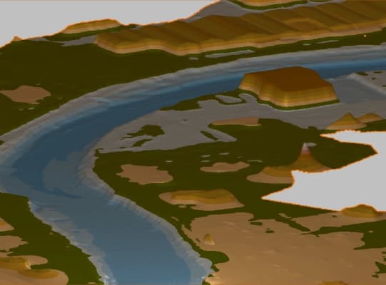
Following the dramatic DANA of October 2024, the municipalities of Paiporta and Picanya were faced with the need to assess the impact of the event on critical areas such as the Barranco del Poyo. Among the main challenges were:
- Accurate LiDAR data captured in large and complex areas of difficult access.
- Processing and analysis of large volumes of data obtained from multiple UAV flights, while maintaining their quality and usefulness.
- Generation of detailed digital models to facilitate the planning of necessary interventions.
This data has been published in the DIGITAL.CSIC repository..

Solutions
The SeaDron group of the Institute of Marine Sciences of Andalusia (ICMAN), oversaw flights with a DJI Matrice 300 RTK drone, equipped with the Zenmuse L2 sensor, executing 7 LiDAR flights. The captured data were initially processed with DJI Terra v4.3.0, generating a high-density point cloud and a Digital Elevation Model (DEM) at a 1:500 scale. Kinematic post-processing techniques with external GNSS bases were used to calculate trajectories, with the company ATyges providing technical assistance and advice during the data processing phase.
The 2015 Digital Terrain Model - DTM02, and the post-event aerial images of the Dana 2024 Special were also downloaded from the National Center for Geographic Information (CNIG).

- Interactive visualization of the point cloud to identify critical areas and relevant terrain details.
- Tools to accurately measure, generate cross-sectional profiles, and analyze terrain variations with precision.
- Comparison of digital terrain models before and after the catastrophe, detecting topographic changes caused by the event.
- Publication of the results in a web viewer, facilitating remote access to the information for the public from any device.

Benefits
The project demonstrated the usefulness of the technologies that transform complex data into accessible, high-value information for decision-making. Among the most outstanding benefits are:
- Integration and comparison of geospatial data from different technologies, sources, and periods, enabling comprehensive assessment of topographic changes and their impact on the terrain.
- Advanced visualization and analysis, facilitating the interpretation of the point cloud and extracting accurate measurements, cross-sectional profiles, and other key data for intervention planning.
- Publication in a web viewer that made it possible to share results collaboratively, providing remote access to authorities and technical teams involved.
This success story as the Tcp PointCloud Editor software facilitates the transformation of complex data into strategic tools. We thank ICMAN-CSIC, DIGITAL.CSIC and IGN for their valuable collaboration in providing the data.
