
Project challenges
3D point clouds are increasingly generated in projects through aerial surveys, UAVs, SLAM, and terrestrial laser scanners. These devices are becoming more affordable, allowing them to be used in smaller projects. Although point clouds have been used in various CAD programs for several decades, most are expensive and often require significant time to generate results. In fact, even today, many CAD programs on the market do not work with point clouds.
The size of 3D point cloud files is often a limiting factor, as it varies from tens of megabytes to tens of terabytes. Generally, the data remains isolated in projects, and its full potential is not leveraged. This situation greatly limits the use of 3D point clouds in projects. There is a need for a manufacturer-independent software solution that allows for easy and efficient generation of native 3D CAD models from point clouds of any origin.
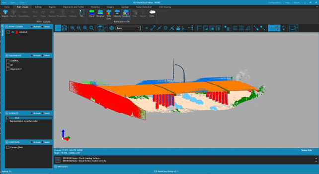
Classified point cloud with 3D modeling
Solutions
The SOUTH ME SLAM RTK device was selected to perform a bridge measurement test. The work area was measured in several minutes, which was the time it took to traverse it. The result was a detailed, georeferenced, and colored 3D point cloud.
The tcp PointCloud Editor software is an independent and affordable solution that was used to convert the 3D point cloud into a 3D model. Importing the point cloud into the program took a few minutes. The program's extensive tools allow for creating point cloud classifications, sections, profiles, digital terrain models (DTM), and extrusions for complex shapes and geometries.
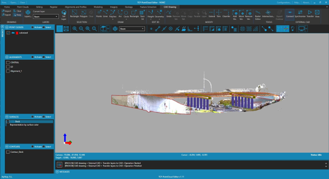
RGB point cloud with 3D modeling
Benefits
- The final result was a 3D model in DWG format, compatible with any CAD software on the market that supports the DWG industry standard.
- The total processing time in the office, from the 3D point cloud to the 3D CAD DWG model, was less than 30 minutes.
- The original 3D LAS point cloud had a file size of 1.1 GB, making it difficult to email or use with other programs. The DWG model generated by tcp PointCloud Editor had a size of 329 KB (0.3 MB), so it could be easily emailed and used in third-party CAD packages.
- The learning curve was minimal and had good support thanks to documentation and training videos.
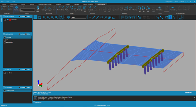
3D entities deck surface represented as 3D faces