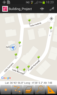
APLITOP has added new functions to its TcpGPS Lite software for mobile devices with Android operating system, for rapid surveys using the integrated GPS of your mobile phone or tablet with its nominal precision, very easily.
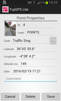
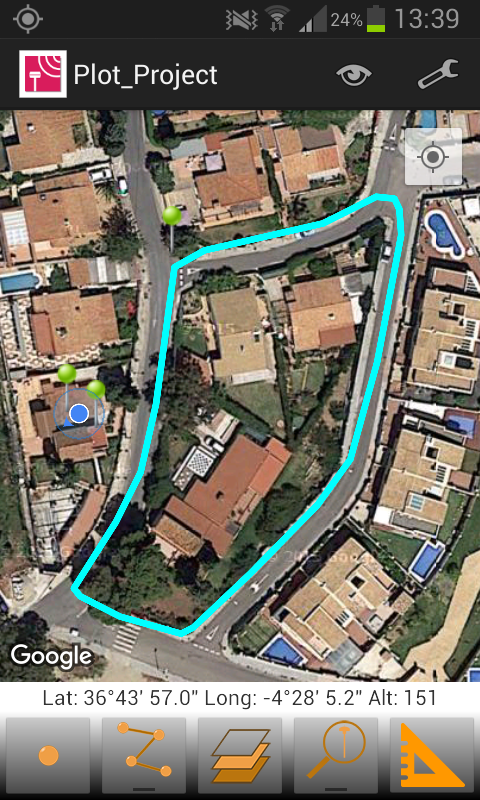
As basemap Google MapsTM is used, being able to switch between the standard mode, satellite, hybrid and terrain. At all times the current geographic or UTM projected coordinates are displayed. Among the features are: survey single point, continuous survey, measurement of distances and file export sending by email in formats: Google Earth KML, CAD DXF and text.
It is also possible to link pictures captured with the phone or tablet to points, to open them afterwards with our application TcpMDT. This is just one more step of APLITOP commitment to develop other applications of its complete product porfolio for Android. So TcpGPS basic and full versions connected to GNSS professional receivers will be also available soon for this operating system.
And besides, TcpGPS Lite for Android can be downloaded free from Google Play Store from your mobile phone or tablet !